

Solution
Digital Twin & Smart Infrastructure
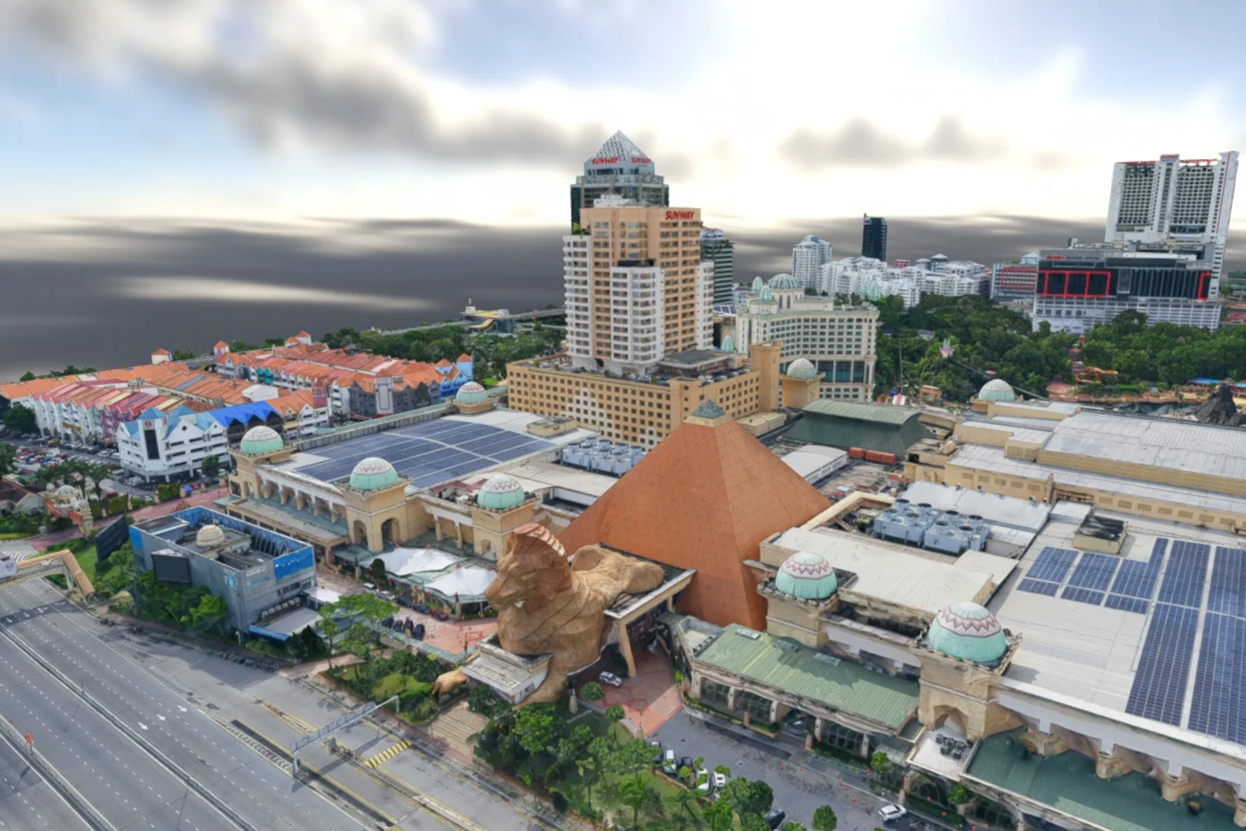
High-accuracy 3D asset modelling, reality capture integration and intelligent digital twins, engineered to optimise municipal operations and civil lifecycle management.
- Largest twin
- 9.5 sq km in three hours
- Model types
- 3D mesh, Gaussian Splats, point cloud
- Access
- In the browser, nothing to install
- Integrations
- Planning, GIS and asset systems
The challenge & transformation
Infrastructure planning and facility management suffer from fragmented data silos, outdated CAD blueprints and poor spatial visibility, which surface later as costly design clashes and delayed maintenance cycles. By combining high-density aerial LiDAR, mobile mapping point clouds and 3D reality modelling, AECA Solutions transforms how physical assets are conceived and managed, building digital twins from capture accurate to 1 to 3 centimetres rather than from a drawing.
This approach compresses project lifecycles, consolidating complex infrastructure data into a single interactive environment every stakeholder can reach. By replacing static blueprints with survey-grade spatial replicas, your organisation can simulate future development, streamline facility management and cut operational overhead, delivering reliable infrastructure intelligence faster than before. One flight has covered roughly 9.5 sq km of city centre in three hours.
Planning a municipal digital twin or a smart infrastructure project?
Speak with a Digital Twin SpecialistThe capabilities & what we deliver
Reality captured accurately, converted into geometry your engineering systems can use, and kept current against the ground.

3D reality capture & mesh modelling
Multi-source drone and mobile LiDAR data converted into detailed, photorealistic 3D mesh models of cities, plants and civil structures.
- High-resolution textured 3D reality meshes
- Complex facility and building facade modelling
- As-built against design BIM model comparison
- Immersive virtual site inspection environments

Smart city & municipal infrastructure integration
Urban asset data, municipal networks and spatial layers centralised into one digital twin platform for city management.
- Municipal utility and zoning integration
- Above-ground asset mapping
- Urban growth simulation and planning layers
- Interoperable GIS, CAD and BIM workflows

Structural health & lifecycle monitoring
Structural deformation monitored, asset wear tracked over time and predictive maintenance planned from a dated spatial record.
- Multi-temporal change detection and tracking
- Structural settlement and deformation analysis
- Predictive maintenance scheduling support
- Complete asset health record management
Need a customised digital twin architecture or specialised BIM integration for your facility?
Request a Custom Technical ProposalApplied by Industries
The industries this work is commissioned in, and what a measured twin changes in each.
City-wide master planning, municipal service delivery and urban digital twins managed on one coordinate system.
Design, construction and long-term asset management of major civil works, bridges and industrial plants, run against a model that matches the ground.

Measured models of mills, stores and estate infrastructure, so plant upgrades are planned against the building as it stands.
Terrain and building models detailed enough to simulate flood spread and evacuation routing before an event.

Terrain and canopy surfaces carried in the same model as the built environment, for shading, drainage and green cover analysis.

Facility security planning, emergency response training and critical infrastructure defence using immersive 3D simulations.
Ready to bridge physical infrastructure with intelligent digital twins and survey-grade spatial precision?
Schedule a Consultation Today

