





Loading

Industry

Agriculture & Plantation

Drone mapping, LiDAR and AI to help plantations and farms monitor crops and improve operations.

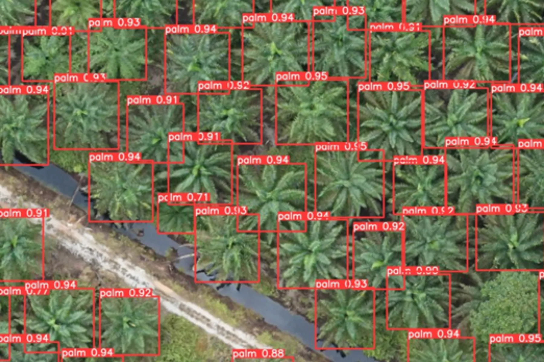
Aerial view of an oil palm block in Malaysia with automated tree detection run over it, each palm marked by a labelled box and a confidence score, and a drainage channel crossing the block
Largest survey
10,232 ha, eight estates
Sensing
Multispectral and RGB
Analysis
AI health classes, NDVI and NDRE
Deliverable
Estate-wide digital inventory

Capabilities in this sector

The named services AECA delivers here. Each one answers a problem set out below.

AI-Powered Tree Counting & Inventory

Stand counts get extrapolated from sample plots, so the estate is managed on an estimate.

Multispectral Canopy Health Monitoring (NDVI & NDRE)

By the time stress is visible from the ground, the affected area has already spread.

Crop Stress Detection

Walking an estate samples a fraction of it, and that fraction rarely includes the problem.

Industry challenges

Malaysian estates are run at the scale of thousands of hectares but measured at the scale of a field walk. Everything below follows from that gap.

Manual scouting cannot cover the estate

Tracking health and auditing counts on foot across thousands of hectares carries logging error and leaves much of the estate unrecorded between cycles.

Management operates without spatial intelligence

Without accurate spatial data, teams forecast production inaccurately, intervene late on pest and disease, and waste fertiliser.

Problems are found only once they are visible

Nutrient deficiency, water logging and pest pressure are detected when a scout can see them, by which point the affected area has grown.

One fertiliser rate across every block

A single rate assumes every stand needs the same thing, so surplus is absorbed without a yield return and deficient stands stay untreated.

AECA's solutions

Fixed-wing multispectral survey covering up to 700 hectares a flight, calibrated in the laboratory and delivered at individual-tree resolution rather than block averages.

AI-driven tree counting and auditing

Every stand detected and classified as very healthy, healthy, stressed or dead, giving an auditable inventory that supports financing, insurance and RSPO or MSPO certification.

Multispectral health mapping

NDVI shows where damage has occurred and how severe it is, NDRE catches stress weeks earlier, and both convert into prescription maps so inputs go only where they are needed.

Gap analysis and replanting logistics

Empty pockets, unplanted spaces and dead canopies located to exact coordinates, so replanting is scheduled against a measured list rather than an estimate.

Benefits

What changes for an estate once condition is measured rather than observed.

  • Inventory precision Automated stand extraction removes counting error and gives a baseline the next survey can be compared against.
  • Optimised land utilisation Gaps, dead palms and open spaces are pinpointed, so replanting is streamlined and canopy coverage per hectare is maximised.
  • Early crop stress mitigation Multispectral layers surface nutrient deficiency, water logging and pest infestation before physical signs show from the ground.
  • Data-driven fertiliser inputs Nutrient layers convert into variable rate layouts, redistributing fertiliser rather than cutting or raising it estate-wide.

Case studies

Two plantation programmes AECA has delivered, and what the data changed in each.

Plantation health monitoring across 10,232 hectares

The challenge
RISDA supports thousands of smallholders whose income tracks estate output, and stress a walking scout can finally see has usually been developing for a season.
The deployment
54 flight missions over 21 operational days, flying a Quantum Systems Trinity F90+ with a MicaSense RedEdge-MX and a Sony UMC R10-C, held to centimetre control by CHCNAV i83 GNSS.
The result
Every tree classified as very healthy, healthy, stressed or dead. Over 85% returned healthy or very healthy, and NDRE located early stress pockets weeks before anything was visible from the ground.


Tree-by-tree nutrient mapping across 4,180 hectares

The challenge
One rate applied across every block meant surplus was absorbed without a yield return, and deficient stands went unrecorded until the shortfall showed.
The deployment
20 days of multispectral survey calibrated against 120 Frond 17 leaf samples laboratory tested for nitrogen, phosphorus and potassium, held to 41 ground control points and delivered as 4 cm orthophotos.
The result
At one estate over 33,000 stands read above-normal nitrogen and over 47,000 carried excess potassium; at another, 1,693 stands were confirmed nitrogen deficient. The findings now shape the fertiliser strategy.

Gap analysis before a replant cycle

The challenge
Replanting is scheduled from a stand count that was sampled rather than measured, so empty pockets and dead palms stay on the books and out of the budget.
The deployment
Every stand is detected and positioned from the survey, with gaps and dead canopies located to exact coordinates.
The result
A positioned replanting list and an auditable inventory that also stands up in certification and financing.

Turn insight into action

Solve your next operational challenge.

Tell us what you need to measure, monitor or manage.
