




Loading

Industry

Environment & Forest

UAV mapping, LiDAR and analysis to monitor environmental impact, terrain change and compliance.

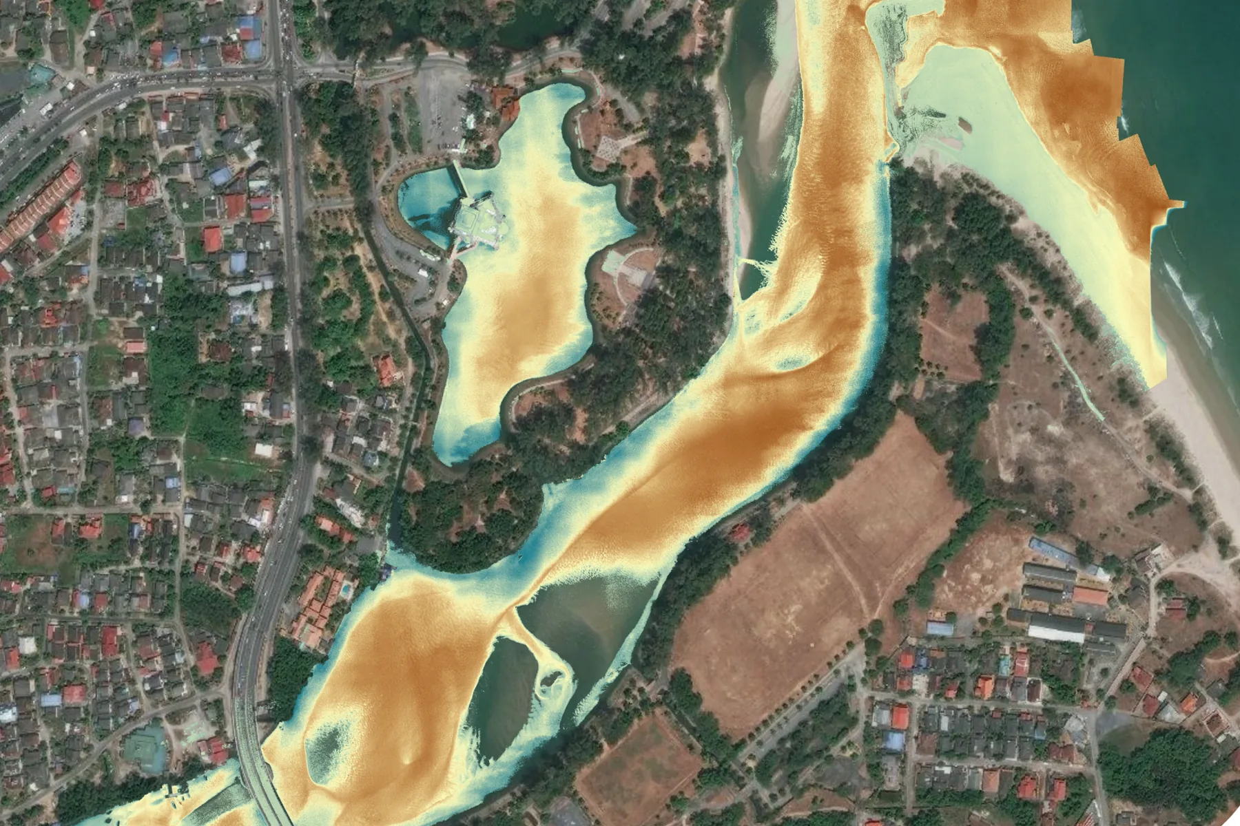
Satellite view of a Malaysian river mouth with a sediment plume classified in orange across the channel and the estuary, beside a village, roads and plantation blocks
Environments
Mines, landfills, river basins
Positioning
RTK and PPK networks
Check accuracy
RMSE 0.06 m
Analysis
Terrain under canopy, volumetrics

Capabilities in this sector

The named services AECA delivers here. Each one answers a problem set out below.

Canopy Mapping & Penetrating LiDAR Survey

Optical survey stops at the top of the canopy, which is where the questions start.

Wide-Area Aerial Ecological Audits

Ground survey cannot cover a reserve, and what it does cover, it covers slowly.

Automated Land-Use and Encroachment Tracking

Clearing and encroachment are found late, usually by someone who happened to be passing.

Industry challenges

Ground survey of expansive, high-risk or inaccessible zones such as active mines, landfills and river basins is slow, labour-intensive and hazardous.

Hazardous ground access

Steep, unstable or contaminated zones cannot be walked safely, so monitoring is limited to the accessible edges and the interior is inferred.

Degradation found late

Erosion, siltation and slope movement progress between infrequent surveys, so the first measurement is often taken after the problem has become expensive.

Compliance evidence is hard to assemble

Impact reporting drawn from scattered field notes and isolated samples is difficult to audit and slow to compile against regulatory and ESG deadlines.

Fire detected by sight, which is late

On large landholdings a fire is reported once someone can see it, and smoke defeats the optical monitoring that might have caught it sooner.

AECA's solutions

Advanced remote sensing and aerial intelligence tailored for environmental asset management.

High-resolution photogrammetry

Multispectral and RGB payloads produce ultra-clear orthomosaics for vegetation health indexing and land cover classification over vast territories.

Canopy-penetrating LiDAR and volumetrics

Airborne LiDAR sees past dense canopy for accurate terrain models, and multi-temporal surfaces track coastal erosion, river siltation and stockpile or landfill volume change.

Satellite wildfire intelligence

AECA brings the OroraTech platform to Malaysia, using satellite thermal detection to raise earlier signals across wider ground than field observation reaches, as a layer alongside the Fire and Rescue Department rather than a substitute for it.

Benefits

What an environmental asset owner gets beyond the imagery itself.

  • Data precision and accuracy RTK and PPK drone networks deliver centimetre-level outputs, reliable enough for topographical modelling and environmental reporting.
  • Risk mitigation and site safety Hazardous, steep or unstable zones are mapped from secure, controlled locations, so ground crews are never sent into them.
  • Regulatory compliance and ESG reporting Auditable digital twins, impact assessments and volumetric data, produced to meet municipal council and global ESG requirements.
  • Workflow integration and analytics CAD- and GIS-ready datasets formatted to drop straight into existing engineering software and asset management workflows.

Case studies

The situations this work is built for, and the shape of the engagement in each.

Terrain beneath the canopy beside a former mining lake

The challenge
A masterplan built around a 28 acre lake sits beside a former mining site where ground falls 40 metres below sea level, under canopy optical survey cannot recover.
The deployment
Drone LiDAR with the Scanfly Ultra X and its Hesai XT32M2X sensor, flown inside an active construction zone, returns classified to separate vegetation from bare earth.
The result
A digital elevation model of the vegetated ground, validated at 0.06 metres RMSE. Paired with multispectral capture, the same flight supports carbon content estimation for green construction reporting.

Volume and surface change on active sites

The challenge
Stockpile and cell volumes are reported from infrequent manual survey, which ages quickly on a working site and puts crews among moving plant.
The deployment
Repeat aerial capture on an agreed cycle, each flight tied to the same control so successive surfaces are directly comparable.
The result
Volume and surface-change reporting between any two dates, produced without a survey crew on the ground.

Reserve boundary and encroachment watch

The challenge
Clearing inside a buffer zone is discovered long after the fact, because the boundary is too long and too remote to patrol on the ground.
The deployment
The boundary is captured on a repeating cycle, each pass differenced against the last to isolate where cover has changed.
The result
Change flagged by location and date, early enough to act on, with a dated record that supports enforcement.

Turn insight into action

Solve your next operational challenge.

Tell us what you need to measure, monitor or manage.

