


Loading

Industry

Disaster Management

Hazard mapped before the event, extent mapped during it, damage quantified after. AECA gives response agencies fast-turnaround aerial and satellite intelligence at the point where a day of delay changes the outcome.

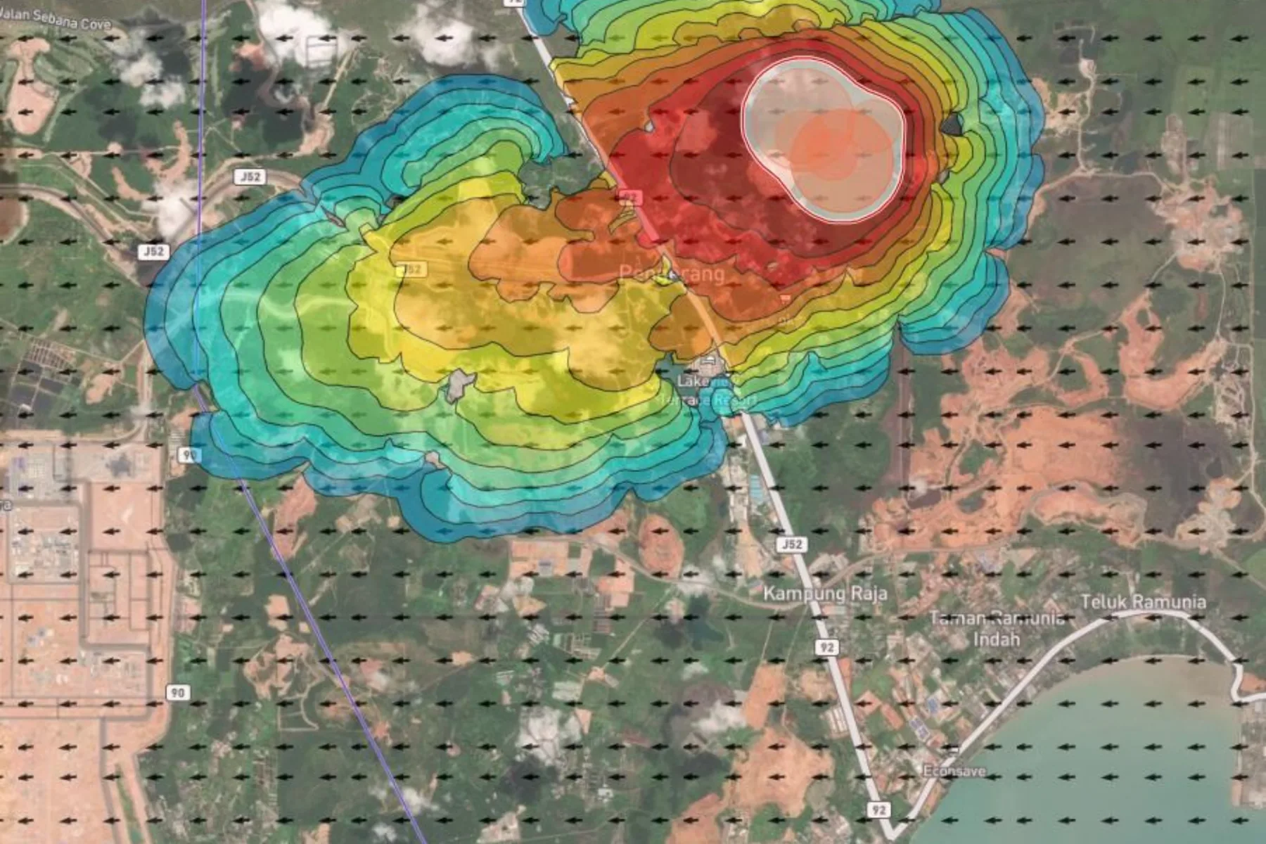
Hazard model over a coastal industrial district in Johor, showing a contoured intensity surface graded from blue through red across the map with a wind field plotted over the surrounding area
Turnaround
Fast-turnaround aerial intelligence
Hazards
Flood, landslide, wildfire
Sensing
LiDAR, thermal, multi-satellite
Target
Response and planning agencies

Capabilities in this sector

The named services AECA delivers here. Each one answers a problem set out below.

Hazard Analysis

Hazard zoning gets drawn from inherited terrain data and past incidents, not from current ground.

Rapid-Response Disaster Risk Mapping

In the first days after an event, the map that would direct the response does not exist yet.

Flood Extent & Impact Mapping

Once water recedes, the evidence of how far it reached degrades within days.

Industry challenges

The window in which a map changes a decision is measured in hours, and the terrain that most needs mapping is the terrain nobody can safely walk.

Post-disaster baseline blindspots

When floods, landslides or fires hit, response teams have no immediate map of the impacted zone, which slows risk assessment and recovery planning.

Hazard invisible until it moves

Slope movement is small and slow between visits, so without a measured baseline to difference against, the first reliable signal is the failure itself.

Ground truth costs responder exposure

Assessing a landslide scarp, an undercut embankment or a fire front from the ground puts the assessor inside the hazard they are there to characterise.

Smoke, cloud and canopy defeat optical survey

The conditions that create the emergency are the same ones that stop a camera seeing through to what matters.

AECA's solutions

Aerial and satellite capture spanning the full cycle, from hazard analysis before an event through to damage assessment after one.

Rapid-response disaster risk mapping

Fast-turnaround aerial intelligence mapping flood extents and landslide volumes, delivered as map layers authorities can act on immediately.

Flood extent and impact mapping

Terrain models accurate enough to drive inundation analysis, plus post-event capture recording how far water actually reached.

Post-disaster baseline and damage assessment

High-resolution post-event capture quantifying severity to guide rehabilitation and support claims, tied to pre-event control wherever one exists.

Benefits

What changes for a response agency once hazard data arrives in hours rather than weeks.

  • Assessment without exposure The scarp, the fire front and the undercut embankment are characterised from the air or from orbit, with nobody positioned inside the hazard.
  • Hazard as a trend, not a snapshot Repeat capture against fixed control quantifies slope movement and erosion over time, which is what turns monitoring into warning.
  • Layers responders can actually use Outputs arrive GIS-ready, so they drop into the systems an operations room is already running during an active event.
  • Evidence that survives the event A measured record of extent and severity supports recovery funding, insurance and the zoning decisions taken long after the response stands down.

Case studies

How the data has translated into decisions during and after real events.

Landslide risk mapping

The challenge
Slope hazard across vegetated hillside cannot be assessed optically, because the canopy hides the ground geometry that determines whether a face is stable.
The deployment
Canopy-penetrating LiDAR drones mapped the terrain beneath the vegetation, with returns classified to separate ground from cover.
The result
A measured terrain model supporting stability assessment and a baseline for detecting movement on later captures. The work was presented at the International Slope Conference in Kuala Lumpur.


Plantation and forestry fire watch

The challenge
Fire on a large landholding is usually detected by sight, which means late, and smoke defeats the optical monitoring that might have caught it earlier.
The deployment
Multi-satellite thermal monitoring with AI hotspot detection running continuously, through the OroraTech platform AECA brings to Malaysia, alongside the Fire and Rescue Department.
The result
Detection moved from visual confirmation to thermal anomaly, with spread modelling directing where crews and equipment are sent first.

Post-event extent and severity

The challenge
Once water recedes or a fire burns out, the evidence of how far it reached degrades within days, and recovery funding depends on it.
The deployment
Rapid aerial and satellite capture of the affected zone as soon as conditions allow, tied where possible to pre-event survey control.
The result
A quantified record of extent and severity supporting rehabilitation planning, claims and revised hazard zoning.

Turn insight into action

Solve your next operational challenge.

Tell us what you need to measure, monitor or manage.

