

Product
Skyline
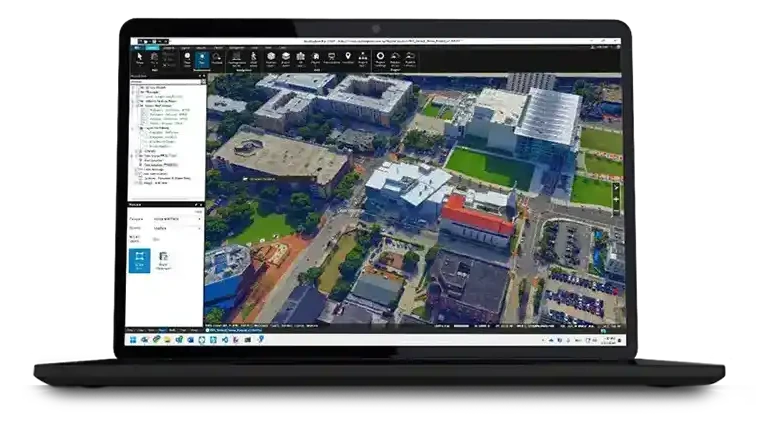
The software layer that turns captured data into a 3D model anyone in the organisation can open, measure and act on.
- Type
- 3D geospatial software
- Builds
- Photogrammetric mesh from imagery
- Publishes
- Browser and desktop clients
- Integrates
- Point clouds, imagery, GIS layers
Key features
What it takes for a 3D model to be used by a department rather than admired by a survey team.
Mesh reconstruction from imagery
Photogrammetric processing turns overlapping aerial capture into a textured 3D mesh of the area, which is the model form a non-specialist can read at a glance where a point cloud is not.
One scene, every layer
Mesh, point cloud, terrain, imagery and vector GIS layers load into the same scene against a common reference frame, so the comparison work happens in the software rather than in someone's head.
Measurement and analysis in the model
Distance, area, volume, slope and line-of-sight are measured directly against the captured geometry, so a question about the site is answered in the model instead of triggering another site visit.
Published to a browser
Scenes are served to a web client, which puts the same model in front of a councillor, a contractor and a field crew without a GIS licence or a workstation.
Technical specifications
Software, so the numbers that matter are the hardware it runs on and the volume it has to process.
Full specifications on request Processing time, cluster requirements and licensing depend on project extent, image count and target resolution, and the published scene's hardware needs differ from the reconstruction machine's. AECA supplies current manufacturer documentation and sizes a configuration against your actual project volumes.
Use cases
Digital twin for a city or district
The reconstruction and publishing layer behind the urban modelling AECA delivers for government and smart city programmes, where the model has to reach several departments at once.
Planning and development simulation
Proposed schemes placed into the captured scene so massing, shading and access are seen rather than argued from elevations.
Infrastructure and corridor review
Long linear capture held as one navigable scene, with measurement against the as-built geometry rather than against the design drawing.
Stakeholder and public consultation
A browser-published scene is something a non-technical audience can be walked through, which is a different job from a report and needs a different artefact.
Other products
Compare platforms and payloads for your mission.
Technology consultation
Find the right technology.
Tell us your mission, payload and environment. We will recommend a suitable platform.


