

Product
GreenValley
LiDAR360MLS: the software that turns a mobile mapping point cloud into classified assets, drawings and road condition results, whichever scanner collected it.
- Product
- LiDAR360MLS
- Type
- Point cloud processing software
- Accepts
- Vehicle, backpack and handheld capture
- Outputs
- Classified cloud, vectors, DEM, DSM
Key features
A processing chain that starts at the raw cloud and ends at the deliverable, with the slow manual steps handled by trained models.
Works with the scanner you already have
LiDAR360MLS processes point cloud and image data from mainstream vehicle-mounted, backpack and handheld mobile mapping systems, so the software is chosen on what it produces rather than on who supplied the scanner.
Classification and extraction by trained models
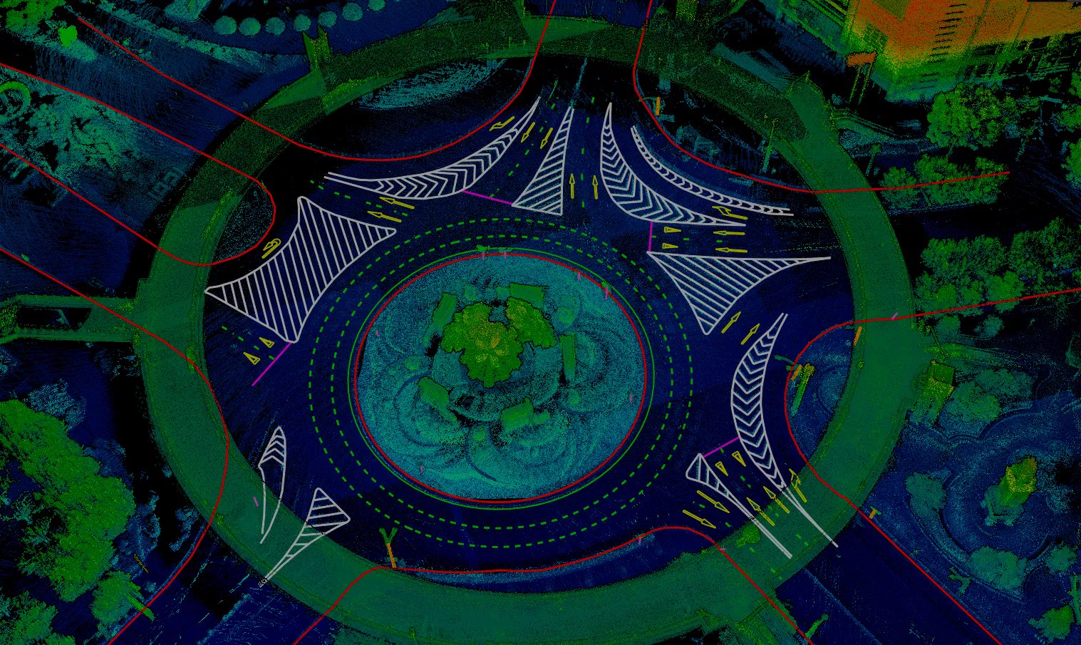
Automatic extraction of more than 100 types of map feature, including roads, buildings and poles, with scene classification covering urban road, forestry, railway, underground car park and shopping mall data. Custom models can be trained against your own symbol library.
Road condition in the same workspace
Pavement damage detection and Pavement Condition Index calculation, alongside section assessment, clearance and visibility checks, height limit verification and terrain products generated directly from the cloud.
Batch workflows rather than repeated clicks
ModelBuilder runs point cloud, vector and raster jobs as one-click batch workflows, and the cluster computing engine spreads georeferencing, processing and reconstruction across machines when a project stops fitting on one.
Technical specifications
This is software, so the figures that matter are the ones your survey data already carries.
Full specifications on request Point density, accuracy and coverage are set by the scanner and the survey rather than by LiDAR360MLS, and the software is licensed by module, so a useful quotation starts from what you capture and what you have to deliver. AECA supplies current GreenValley documentation, the module list and a configuration matched to your data and output formats.
Use cases
Road inspection and maintenance
Pavement damage detected and scored from a drive-through survey, so a maintenance programme is prioritised on measured condition rather than on inspection rounds.
Urban asset and utility survey
Poles, signs, kerbs, drainage and street furniture extracted as attributed GIS features, with an editable attribute table and geometric checks behind them rather than a manually digitised layer.
HD map production and labelling
Lane geometry, markings and roadside furniture vectorised from the cloud, which is the base layer that autonomous and ADAS work is built on.
As-built drawings and digital twin
Floor plans, facade surveys and Revit models produced from the same captured cloud, and road scenes exported as component-level 3D models for a twin or a simulation.
Other products
Compare platforms and payloads for your mission.
Technology consultation
Find the right technology.
Tell us your mission, payload and environment. We will recommend a suitable platform.


