

Solution
Geospatial Intelligence & Mapping
Precision geospatial data capture and mapping for infrastructure, agriculture and the built environment, delivering actionable data for surveying, planning, GIS and digital twin applications.
- Survey accuracy
- 3–5 cm typical accuracy
- Multi-platform capture
- Air · Ground · Mobile
- Multi-sensor capability
- LiDAR · RGB · Multispectral
- Decision-ready data
- GIS · CAD · BIM · Digital Twin
The challenge & transformation
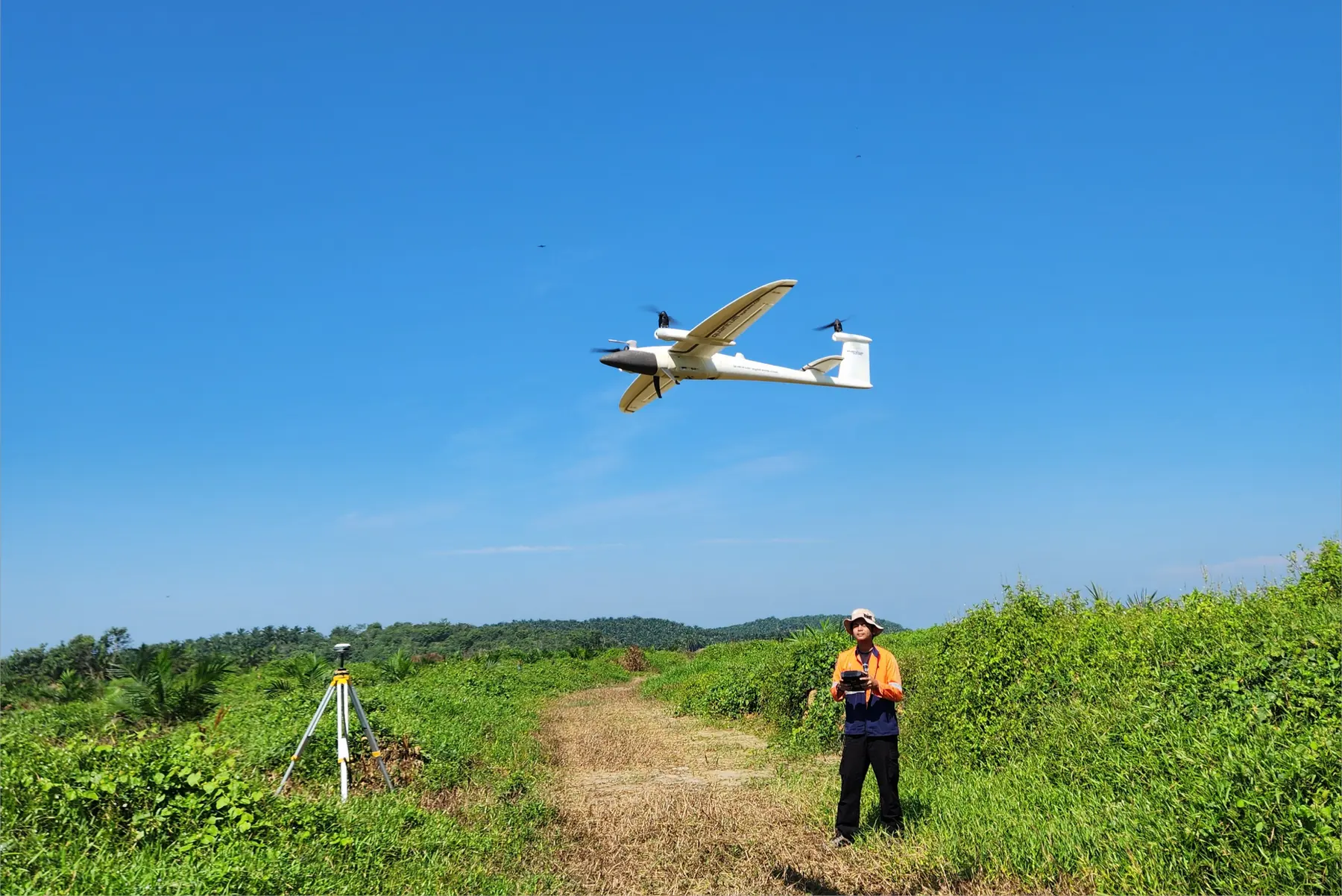
Traditional surveying methods often demand gruelling weeks in the field, exposing crews to difficult terrain while slowing down critical project timelines. By deploying advanced, survey-grade drones equipped with high-precision GNSS/PPK technology and industrial payloads, AECA Solutions transforms how spatial data is captured, achieving survey-grade accuracy of 1 to 3 centimetres horizontally without the bottlenecks of conventional ground surveys.
This high-performance approach compresses project lifecycles, capturing hundreds of hectares of high-density point clouds and aerial imagery in a fraction of the time. By replacing days of manual field labour with automated, precision flight paths, your operations save valuable hours and cut operational overhead, delivering reliable, high-precision intelligence faster than before.
Unsure if drone mapping fits your site requirements?
Speak with a Geospatial SpecialistThe capabilities & what we deliver
Aerial LiDAR, photogrammetry and GIS integration, combined into complete geospatial datasets.

LiDAR point cloud generation
Penetrate dense vegetation and capture high-density 3D laser measurements to model complex terrain and infrastructure with survey-grade precision.
- Airborne and mobile LiDAR data acquisition
- Dense point cloud classification and filtering
- Bare-earth digital terrain model (DTM) extraction
- Detailed structural and corridor clearance analysis

GIS data integration
Bridge raw aerial data into your existing enterprise geographic information systems for streamlined analysis and decision-making.
- Custom spatial database structuring and management
- Interoperable format conversion for CAD, GIS and BIM workflows
- Layer stacking, spatial querying and thematic mapping
- Enterprise-ready GIS dashboard and asset tracking synchronisation

Aerial photogrammetry & topographic mapping
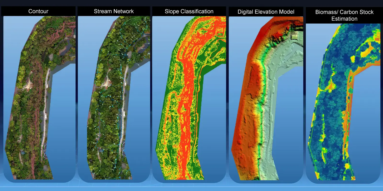
Transform high-resolution aerial imagery into survey-grade 3D models, digital elevation models and detailed contour maps.
- High-density orthomosaic image generation
- Precise 3D point cloud and mesh modelling
- Automated contour and elevation data extraction
- Volumetric measurements and surface analysis
Need custom payloads or specialised flight paths for complex terrain?
Request a Custom Technical ProposalApplied by Industries
The same capability, set against the operating problem of each industry we work in. Every tile opens the work in detail.

3D digital twins and parcel mapping for urban planning, simulation and the spatial layer a smart city programme is built on.

Construction progress, road alignment, powerline inspection and utility corridor mapping across civil projects and maintenance programmes.

Multispectral mapping for NDVI health indices, early crop stress and nutrient deficiency, with automated tree counting for plantation inventory.

Hazard analysis, flood inundation mapping, slope stability assessment and wildfire monitoring for risk mitigation and emergency response.

Forest carbon sink calculation, biomass estimation and canopy change tracking for sustainability and carbon offset programmes.

Situational awareness and tactical monitoring from advanced aerial platforms, including rapid-deployment survey for time-critical operations.
Ready to elevate your project with survey-grade geospatial intelligence?
Schedule a Consultation Today

