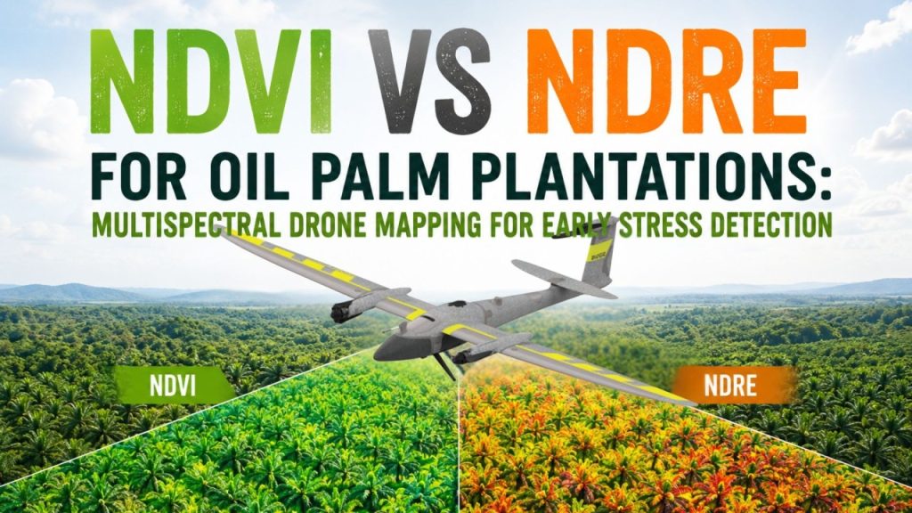
PKPS in Malaysia used multispectral drone mapping, GIS analysis, and laboratory-calibrated nutrient assessment across 4,180 hectares to identify over-fertilisation, target deficiencies, and build a precision nutrient management program from the ground up.
Why uniform fertiliser programs create hidden costs in oil palm plantations
Precision agriculture promises something every plantation operator wants: the ability to apply the right intervention, at the right location, at the right time.
In oil palm plantations, fertiliser management is one of the most important applications of precision agriculture because fertiliser represents one of the largest operating costs and has a direct impact on productivity.
Yet many estates continue to rely on uniform fertiliser application despite significant nutrient variation across blocks, fields, and individual stands.
Ask any large-scale plantation manager how their fertiliser program works, and the answer is often the same: a standard rate applied uniformly across the estate.
It is a method born from practicality. When managing thousands of hectares and hundreds of thousands of stands, a single program is easier to administer than a highly tailored one.
But ease of execution comes with a cost.
Uniform fertilisation assumes every block, every row, and every stand has identical nutritional requirements. In reality, nutrient availability varies significantly due to soil conditions, topography, drainage, planting history, and previous fertiliser applications.
Over-fertilise an area where nutrients are already abundant and you risk what agronomists call luxury consumption. The stand absorbs nutrients beyond what is agronomically useful, increasing fertiliser costs without generating corresponding yield improvements.
Under-fertilise a genuinely deficient area and yield potential remains unrealised, sometimes for multiple growing cycles before symptoms become visible through routine field inspection.
This was the challenge facing Perbadanan Kemajuan Pertanian Selangor (PKPS), a Selangor, Malaysia-based agricultural development body managing oil palm estates across two states.
The organisation engaged AECA Solutions Sdn. Bhd. again recently to understand exactly what was happening beneath the canopy across 12 estates, 4,180 hectares, and hundreds of thousands of individual stands.

Building a precision agriculture framework with multispectral drone mapping
The challenge was not simply acquiring aerial imagery. It was creating a sufficiently detailed and scientifically validated picture to support field-level fertiliser decisions.
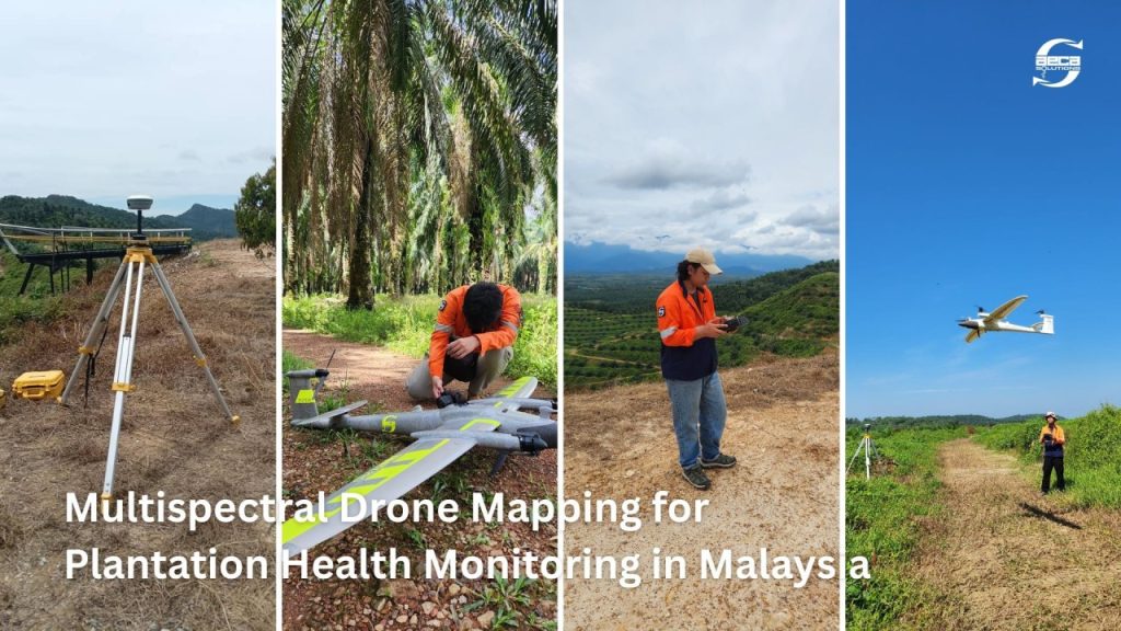
AECA Solutions conducted aerial surveys over 20 days using the Quantum Systems Trinity F90+ eVTOL UAV, a fixed-wing hybrid platform capable of efficiently covering large plantation areas while maintaining high spatial resolution.
The aircraft carried a MicaSense RedEdge-MX multispectral sensor for vegetation analysis and a Sony UMC R10-C RGB camera for high-resolution visual reference.
Multispectral drone mapping provides valuable insight into vegetation conditions, but the reliability of any nutrient model depends on calibration against actual field measurements.
To establish this connection, 120 leaf samples were collected from Frond No. 17, the industry-standard sampling position for oil palm nutrient assessment. The samples were submitted for laboratory analysis to determine measured Nitrogen (N), Phosphorus (P), and Potassium (K) levels.
These laboratory results were then used to calibrate and validate the multispectral models.
Spatial accuracy was ensured through 41 Ground Control Points (GCPs) established using CHCNAV i83 GNSS receivers operating via Real-Time Kinematic (RTK) and Static survey methods.
This delivered centimeter-level geospatial accuracy, allowing analysis at individual tree level rather than broad plantation blocks.

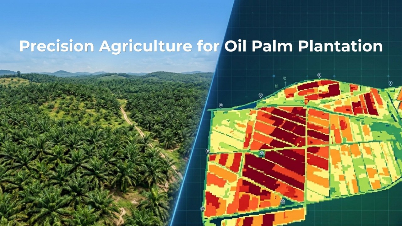
The final outputs included high-resolution orthophotos at 4 cm Ground Sampling Distance (GSD), analysed through Geographic Information Systems (GIS) to generate nutrient distribution maps across the entire plantation portfolio.
The result was not simply another plantation map.
It was a tree-by-tree nutrient assessment across 4,180 hectares something impossible to achieve through conventional field inspections alone.

Oil palm nutrient mapping results
The nutrient maps revealed patterns that would have been difficult, if not impossible, to identify through traditional plantation monitoring methods.
Nitrogen and Potassium surplus were widespread. Across most estates, N and K levels were reading above the optimum range.
At one of the estates alone, over 33,000 stands showed above-normal Nitrogen levels, and over 47,000 showed excess Potassium.
At the current fertiliser application rates, significant portions of these inputs were contributing to luxury consumption absorbed by the trees without producing proportional yield returns.
Phosphorus was stable. No estates showed significant P deficiencies or excesses.
Levels held in the high-normal range throughout, suggesting the existing P program was broadly appropriate, one of the few areas where the current approach did not need adjustment.
Another estate was a critical exception. While most estates were dealing with excess, this estate presented the opposite problem: 1,693 stands with confirmed Nitrogen deficiency.
Without targeted intervention, these stands would continue underperforming, creating an avoidable drag on estate productivity. The deficiency may have remained unnoticed under a conventional uniform fertiliser program.
Most importantly, the nutrient mapping exercise gave PKPS something it had never previously possessed: distribution-level visibility.
Not an estate average.
Not a block average.
A clear understanding of which stands were deficient, which were excessive, and which were within the desired range.
Precision fertiliser recommendations based on drone mapping data
A nutrient map only becomes valuable when it informs action.
Based on the findings, AECA Solutions developed fertiliser recommendations tailored to individual estate conditions.
For estates exhibiting Potassium and Phosphorus surplus, reductions in Rock Phosphate (RP) and Muriate of Potash (MOP) applications were recommended. Continuing current application rates would increase costs while potentially creating nutrient imbalances and antagonistic interactions between minerals.
For the affected estate, the recommendation was different.
Targeted Nitrogen and Urea applications were recommended for the identified deficient zones. Broad reductions across the plantation portfolio would have worsened conditions in this estate while attempting to correct excess elsewhere.
The project also established a baseline for future monitoring.
Precision agriculture is often described as the practice of managing variability rather than managing averages.
Traditional plantation management typically relies on estate-wide or block-wide recommendations. Precision agriculture seeks to understand conditions at a much finer scale and respond accordingly.
The PKPS project exemplified this approach. Instead of assuming all stands required the same fertiliser inputs, nutrient conditions were measured, mapped, and analysed across individual trees and locations.
The outcome was not simply better visibility. It was the ability to make fertiliser decisions based on actual field conditions rather than assumptions.
In practical terms, this transformed fertiliser management from a uniform program into a precision agriculture strategy.

Periodic multispectral drone surveys aligned with fertiliser schedules would enable PKPS to track nutrient changes over time and continuously refine its precision agriculture strategy.
Applications of multispectral drone mapping for oil palm plantations
The significance of this project extends beyond a single plantation operator.
Precision agriculture has long promised better resource allocation, but implementation has often been constrained by the availability of accurate, large-scale data.
For plantation operators managing hundreds or thousands of hectares, routine field inspections cannot deliver the spatial coverage or frequency required for true precision fertilisation.
Laboratory foliar analysis remains essential, but sample density alone cannot provide complete visibility across large estates.
By combining multispectral drone surveys, laboratory calibration, GNSS-controlled geospatial accuracy, and GIS analysis, plantation operators can obtain estate-wide nutrient intelligence at a practical cost and timescale.
The methodology applied at PKPS can be replicated across oil palm plantations throughout Malaysia, Southeast Asia, and other tropical agricultural regions.
The central question remains the same:
Are the right nutrients being applied in the right places at the right rates?
For many plantations operating under uniform fertiliser programs, the answer is often no.

The business value of precision agriculture in oil palm plantations
Fertiliser remains one of the largest variable costs in oil palm production.
Any program that applies nutrients where they are not required is effectively creating avoidable expenditure.
Multispectral drone mapping transforms these hidden inefficiencies into measurable, actionable insights.
Rather than reducing fertiliser inputs across an entire estate, plantation managers can redistribute resources where they are needed most.
The result is a more informed fertiliser strategy, improved resource allocation, and better operational decision-making.
AECA Solutions helps plantation operators implement practical precision agriculture programs through multispectral drone mapping, GIS analysis, nutrient assessment, and data-driven decision-making.
Whether the objective is fertiliser optimisation, plantation health monitoring, yield improvement, or estate-wide nutrient management, our solutions provide the data foundation required for precision agriculture at scale.
If you manage oil palm estates in Malaysia or elsewhere in Southeast Asia and want a clearer understanding of nutrient distribution across your plantation assets, let’s connect to discuss a scoped assessment tailored to your operations.